I accidentally searched Bing for something the other day and noticed something [mildly] interesting – Bing have added radar elevation data to their maps.

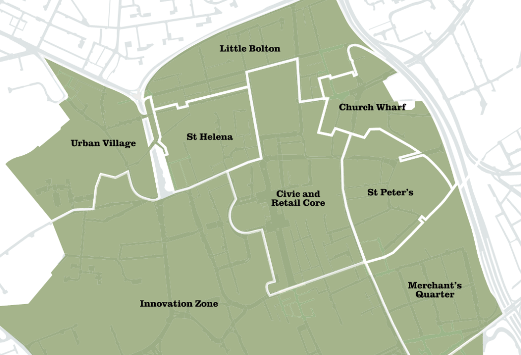
You can see the elevation data in the path of the river Croal as it passes through the south of Urban Village. Hang on, Urban where? “Urban Village”? “Innovation Core”? What are these place names and where have they come from? This is the secondly [mildly] interesting thing about Bing maps. It seems like Bing has got this from the same place as Facebook and Instagram – both clearly think that “Innovation Core” is an actual place:

That’s about it for “innovation core” – the rest seem to be academic papers by people with the surname “Bolton”. How about “urban village”? A bit harder to Google as it’s pretty generic. A press release from the council from 2019 mentions “urban village” nearby, but not as an actual place name, just the concept. A little bit further to the south and west we find “Merchant’s Quarter”:

Bit more Googling…this one is more definite – Merchant’s Quarter was defined in a supplement to the Unitary Development Plan in 2005. And scrolling through, we hit paydirt: “Figure 3 – Bolton Town Centre Character Areas”:

So Bolton Council is the source, although I wonder if whoever supplies this data has been a bit premature in using these neotoponyms?